
Mike Stone Associates, Inc. is a property asset management and consulting firm in the Houston area, and has experienced significant growth since its founding in 2001. MSAi sought a more efficient way to gather measurements and details from field operations. The company initially tried using publicly available satellite imagery, but quickly realized the quality was insufficient for gathering accurate information.
MSAi turned to Nearmap to provide high-quality aerial imagery with frequent updates for use in ArcMap from Esri. Today, Nearmap saves MSAi time and money on site visits and crew dispatch for tasks such as site surveying and measurement. With Nearmap, MSAi can perform these tasks accurately from the office.
CHALLENGE
The GIS department at MSAi was often forced to balance time between in-field measurements and actual office time to align and calculate data to meet their clients’ needs. Traditional approaches to measurement required the GIS tech to be dispatched on-site for lengthy periods of time. Additional time was spent inputting measurements into ArcGIS.
Default basemaps did not provide the level of accuracy clients needed. For example, satellite imagery was typically outdated and lacked resolution detail. New features and buildings were not represented.
SOLUTION
By incorporating Nearmap into their ArcMap/ArcGIS system, MSAi staff no longer needs to spend days in the field manually taking measurements or examining park amenities. With Nearmap, those assets can be quickly and easily analyzed from the comfort of the office.
Because Nearmap imagery is captured approximately every 6 months, Spragg is able to rely on current captures. In high-growth areas like Fort Bend County, public sources of satellite imagery weren’t able to keep up with changes and accurately reflect that growth. High resolution detail also allows MSAi to detect the difference between ground features that satellite simply can’t provide—all with high confidence.
IMPACT
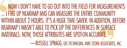
Time savings: A significant amount of time was saved by MSAi technicians who no longer need to spend excessive hours in the field, measuring, photographing, and documenting asset details. There’s no longer a need to walk every inch of sidewalk and pavement with a wheel. They have reduced the actual hours spent on site by a factor of 5, while also saving on equipment and vehicle costs.
Efficient work order communications: Nearmap also works with Cityworks software allowing work orders to include high-resolution imagery. MSAi can now include specific details in work orders which, in turn, allows them to get the job done faster.
Improved presentation quality: The ability to illustrate progress on projects to board members, shareholders, clients is an important part of what MSAi does. With Nearmap, they can now provide visuals that instantly describe both status and direction. The powerful time-slider feature of Nearmap allows a side-by-side comparison to easily illustrate a year’s progress on a project. ■
For More Information: Nearmap captures, manages, and delivers the most current location content in the world, allowing businesses and governments to explore their environment easily. Its high-resolution, frequently updated aerial imagery is 2.8-inch GSD, better than satellite imagery. Delivered within days of capture, Nearmap shows changes over time and is delivered through an easy-to-use interface called MapBrowser or accessed via Esri® and Autodesk products. For more, visit go.nearmap.com.
_________________________________________________________________________
Modern Contractor Solutions, March 2017
Did you enjoy this article?
Subscribe to the FREE Digital Edition of Modern Contractor Solutions magazine.

Clear View Ahead
